Are you planning to visit or move to Portugal and want to learn a bit more about its geography? Then you are at the right place. In this article we will talk about the Portugal map, the regions and districts that make up Portugal, the capitals of Portugal throughout the country’s history, the region of the Algarve and how the map of Portugal has changed over centuries.
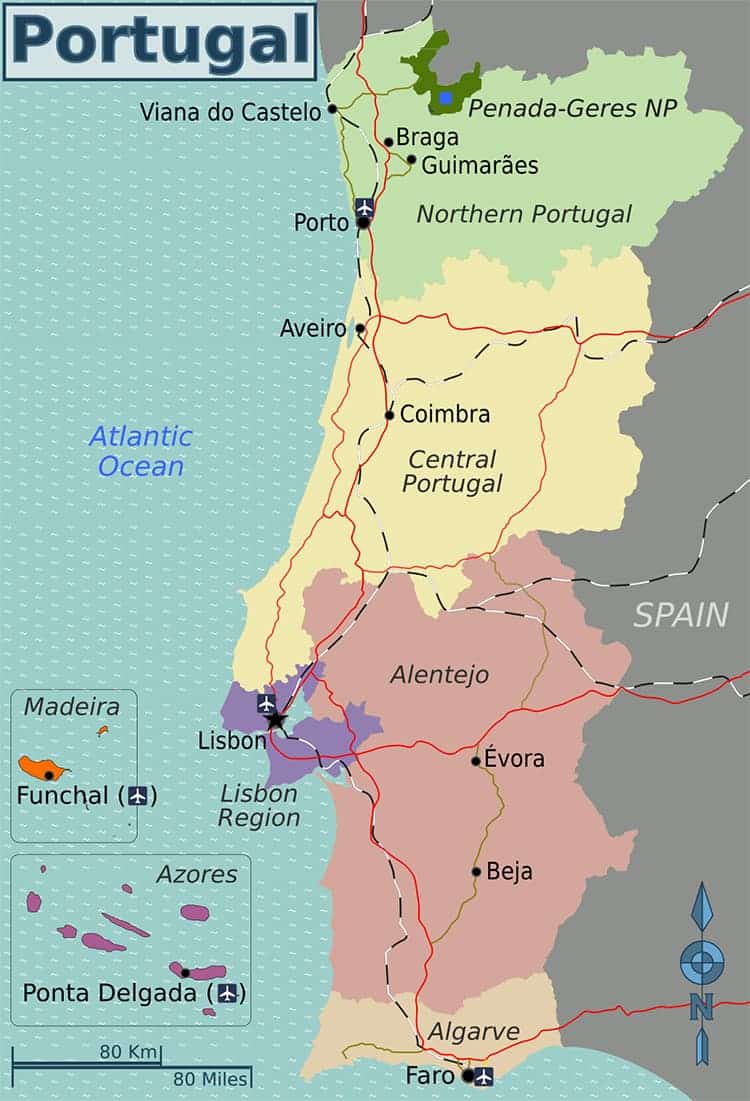
What’s the Portugal map like?
Portugal is the most western country in mainland Europe, bordering Spain. It is located on the Atlantic coast and crossed by several rivers such as the Tagus river, measuring 1,038 km (645 miles) making it the longest river in the Iberian Peninsula originating from Spain and ending in the Atlantic ocean near Lisbon. Portugal has a Mediterranean climate with a distinct wet season at the winters in Portugal. Depending on the region and the time of the year, Portugal offers plenty of sunshine. It is 16°C (61°F) and sunny here in Lisbon at the moment and it’s only the middle of February! If you are on a budget but want to discover a new country, this off-season time might be just the right fit for you. You might like to read: Weather in Portugal, a Detailed Look at the Mainland and the Islands
What are the main regions of Portugal?
The Portugal map is divided into the following regions
The Azores and Madeira are Autonomous Regions of Portugal and together with continental Portugal, they form the whole of the Portuguese Republic.
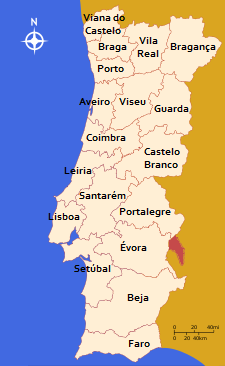
What districts make up Portugal today?
Currently, mainland Portugal is divided into 18 districts:
- Aveiro
- Beja
- Braga
- Bragança
- Castelo Branco
- Coimbra
- Évora
- Faro
- Guarda
- Leiria
- Lisbon
- Portalegre
- Porto
- Santarém
- Setúbal
- Viana do Castelo
- Vila Real
- Viseu
In the Azores and Madeira, the districts were disestablished in 1976, after the autonomous regions were created.
Major cities of Portugal
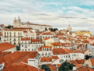
Lisbon
Lisbon is the capital and largest city in Portugal. It’s a hilly city located on the western coast of Portugal. It’s here where Portugal’s main river, the Tagus, flows into the Atlantic Ocean. The city’s charming historical architecture, culture, the amazing climate and sights contribute to attract a large number of tourists every year (over 4.5 million annually).
Porto
Porto is the second largest city in Portugal after Lisbon. It is located along the Douro river estuary in northern Portugal. The city is mainly known for its delicious Port wine, which is typically sweet.
Braga
Braga is located in the northwestern part of Portugal, in the historical and cultural Minho Province. It was the European Youth Capital in 2012.
Coimbra
Coimbra is a riverfront city in the centre of Portugal. The city is famous for its University which is the oldest in Portugal.
Aveiro
Aveiro is situated on the Western part of Portugal along the lagoon called Ria de Aveiro. They call it the Venice of Portugal due to its system of canals and boats similar to the Italian town.
Was Lisbon always the capital of Portugal?
The answer is no. Portugal had five capitals throughout its history:
- Guimarães;
- Coimbra;
- Lisbon;
- Rio de Janeiro in Brazil; and
- Angra do Heroísmo.
Coimbra played a very significant role during the Middle Ages, when it began to evolve into a major cultural centre, mainly due to establishing the University of Coimbra. The city was the capital of Portugal from 1131-1255.
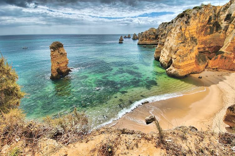
Where is the Algarve on the Portugal map and what’s so special about this region?
The Algarve is the southernmost region of continental Portugal bordered on the southern and western coasts by the Atlantic Ocean and on the east by the Spanish region of Andalucía. The region’s capital is Faro. The Algarve’s distinctive beaches with its striking cliffs rightly make the region one of the most popular tourist destinations in Portugal.
How has the Portugal map changed throughout history?
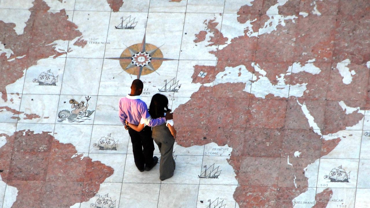
The word Portugal comes from the Romano-Celtic name “Portus Cale”, which reflects Portugal’s history as it was occupied by Celtic tribes until the Romans invaded in 219BC. After the fall of Rome, Portugal became occupied by Germanic tribes and then in 711AD, Portugal and Spain was invaded by conquerors from the Middle East and northern Africa, which brought the Islamic influences to the region. Then, after the Reconquista of the Moors by Christian rulers, The Kingdom of Portugal was formed in 1139 and was ruled over by royal families for centuries in a region that looks similar to today’s Portugal map. This was to change after the Age of Discovery that began in Portugal in the 15th century where Portugal became the home of an empire that reached from Brazil, to parts of Africa, India and China. Since the Independence of former Portuguese colonies in the 20th century, the Portugal map looks as it does today consisting of mainland Portugal, the Azores and Madeira Islands.

Portugal is one of the oldest countries in Europe, the birthplace to some of the world’s most influential explorers and home to spectacular sights. Why not pay a visit?
Did you enjoy learning about the map of Portugal? If you want to know more, just ask us in the comments below.Never miss out on stories about Portugal by subscribing to our FREE newsletter today. If you liked this article, you may also be interested in: All About Portugal: Where, How and Who is Portugal?23 Surprising Facts About Portugal That You Probably Didn’t Know